San Luis Obispo, Santa Barbara and Monterey Counties did not see the widespread damage from yesterday’s bomb cyclone that local officials warned was possible.
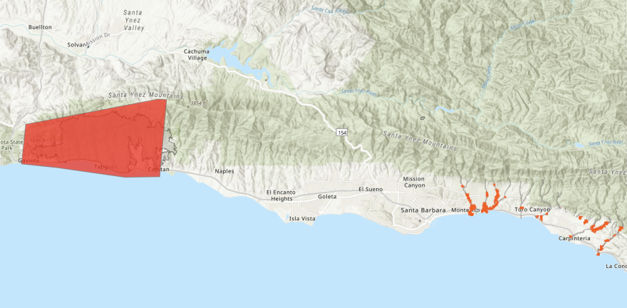
As of this morning, all evacuation orders are lifted for burn scar areas in Santa Barbara County. This includes areas burned by the Thomas, Alisal, and Cave fires in the southern part of the county.
Sheriff Bill Brown announced mandatory evacuation orders for those areas Wednesday afternoon, warning of a major threat to residents. That did not happen, but the area remains vulnerable to future storms because burn scars from past wildfires can see threats like mudslides and deadly debris flow.
However, the county said areas affected by road closures brought on by storm conditions may not be able to repopulate yet. Refugio Road is currently closed due to flooding and Highway 154 is closed due to rock slides. The closure applies to both directions of the highway.
The county is urging residents to be aware of loose and fallen rocks, mudslides, wet road conditions, downed trees and power lines.

The National Weather Service reports that the heaviest rains and high winds of the current storm have passed through Santa Barbara County, though rain is forecast to continue.
Meanwhile, SLO County saw flooding, road closures and power outages, but not on the scale of what local officials considered the worst case scenario. SLO County Office of Emergency Services said in a tweet today that the area "dodged a bullet” with this latest storm.
Monterey County also put evacuation warnings into place across the county, but also did not see major damage or flooding. However, Highway 1 on the Big Sur coast is closed due to rockslides and CalTrans has no estimated reopening time.
To find dispatch numbers, hotlines, warming centers, where to find sandbags and more, visit readyslo.org for SLO County, readysbc.org for Santa Barbara County and this link for Monterey County Emergency Services.


