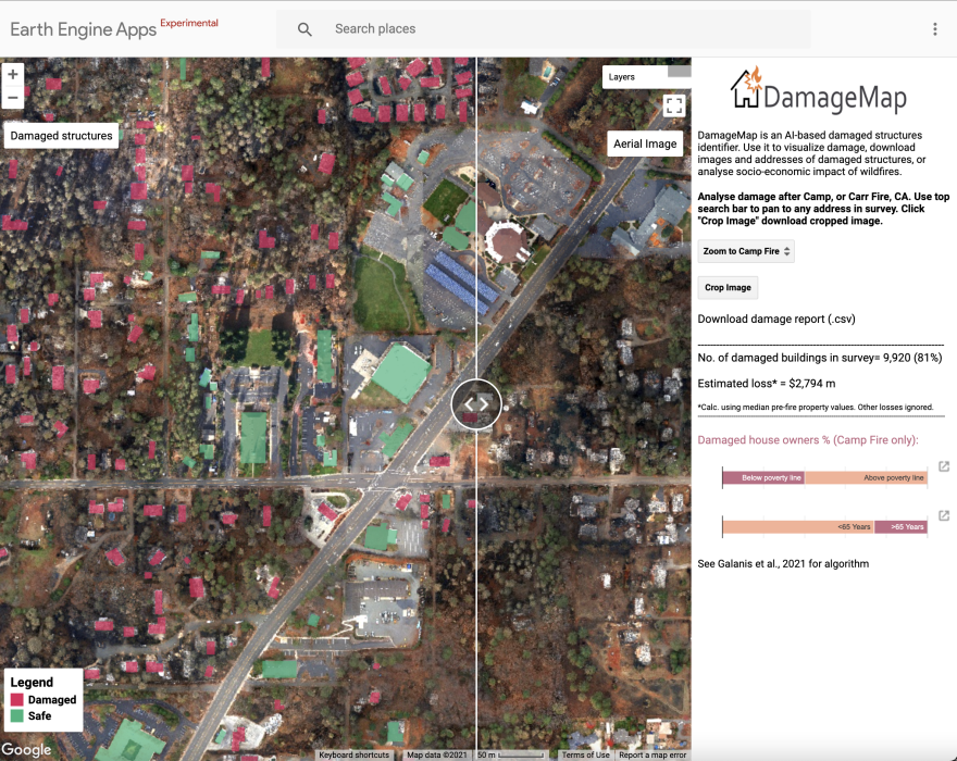
When a wildfire strikes, people are often left wondering for several days or even weeks whether their house is still standing or not. Now, a pair of Cal Poly San Luis Obispo professors and students from both Cal Poly and Stanford have invented an artificial intelligence damage map to assess damage from a wildfire more quickly.
In November 2018, California’s most destructive and deadliest wildfire broke out in Butte County — the Camp Fire. Cal Poly Social Sciences Assistant Professor Andrew Frickers found out that his family home was in the path of the blaze.
“You cross a police line, the evacuation line, and you can't get back in," Fricker said. "So after you leave, you just don’t have any good information about what happened to your structure.”
Frickers' family home was spared, but more than 18,000 other structures were destroyed. That’s when Fricker had an idea: to invent some type of technology to map a destruction zone more quickly, so people don’t have to anxiously wait for word.
Three years in the making, the artifical intelligence “Damage Map” was created.
“This was really born from personal experience," Fricker said. "Just the need, the desperate need for information kind of after a disaster like this.”
Frickers' partner on the project, Assistant Professor Jonathan Ventura, said once images of the ground are taken via helicopter or drone, those images are entered into the computer.
“Basically, it just looks at the images over and over again," Ventura said. "Then it tries to predict if it thinks the building is damaged or undamaged, destroyed or destroyed.”
Ventura said when they tested this technology on California’s recent wildfires, it was over 90 percent accurate as compared to official damage reports.
The team plans to keep testing the Damage Map to increase that accuracy.
“If we are going to be putting out to the public an evaluation of whether their house is destroyed, obviously we want to be as accurate as we can,” Ventura said.
In the future, the Damage Map could also be trained to look for burned-out cars, downed power lines and other safety hazards. The team hopes the technology will soon be deployed to be able to help aid in future wildfires.


