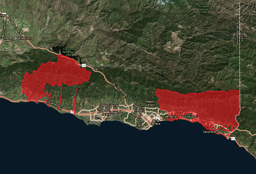
In 2018, mud enveloped Montecito in a severe debris flow that left 23 dead.
The debris flow occurred just weeks after the Thomas fire scorched the hills of Montecito. UCSB Assistant Geography Professor Vamsi Ganti said this left the area particularly vulnerable to a mudslide.
“The highest risk is when you have a post-fire hillside where the erodibility of the hillside is higher,” Ganti said.
UCSB postdoctoral researcher Paul Alessio said when a massive rainstorm happened right after the fire, this created the perfect conditions for a severe debris flow.
“Basically, the fire and then the intensity of the rainstorm caused soil erosion on the hill slopes, so water and mud mixed on the hill slopes,” Alessio said.
When soil is oversaturated by rainfall and can’t absorb water as quickly, a lot of water moves across hills. During Montecito’s debris flows, heavy rainfall turned the water and mud into an uncontrollable slurry mass that tumbled onto the town.
On the fifth anniversary of the tragedy, a massive storm brought record rainfall to the area last month.
UCSB Geography professor Dar Roberts said the storm on January 9 created similar conditions that did put Montecito at risk of another debris flow. This prompted officials to evacuate the area.
However, another deadly debris flow didn’t happen. Roberts said now that the storm has dried up, the risk has significantly decreased.
It’s been almost a month, and there's been a lot of greening up and evaporation and drying, so the soils are probably more than capable of absorbing water again,” Roberts said. “So the risk is not so high unless we get another set of really strong storms to come in.”
Though the risk has gone down, officials are closely monitoring the area.
Ecosystems scientist at UCSB’s Earth Research Institute Marc Mayes said technologies to predict mudslides have rapidly advanced since the 2018 disaster.
“Satellite remote sensing of vegetation conditions after burn events is one type of information, weather forecast information is a second type and then a third type is any type of past legacy data that's been collected on a region's soil and bedrock geology,” Mayes said.
“All three of those things are combined by organizations like the US Geological Survey to come up with landslide prediction maps,” Mayes added.
These advanced technologies allow Santa Barbara County officials to report information to the public quickly in the event that risks increase.
Though the winter storm is now over, there is still a risk of major wildfires this year. Santa Barbara County residents can keep up with emergency alerts at readysbc.org.


